Matsés Complete Historic First Mapping of 3.7 Million Acres of Ancestral Lands and Launch Major New Initiative for Indigenous Empowerment!
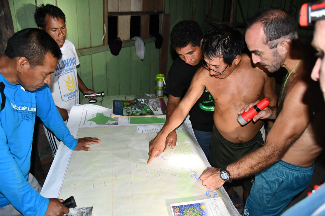
On the 50th anniversary of sustained contact with the outside world, leaders of the Matsés tribe of the Peruvian Amazon assembled to unveil the first completed maps that demarcate their ancestral territories.
The gathering, held on August 28 and 29 at the village of Remoyacu, in the remote frontier divide of northeast Peru and Brazil, was the culmination of an extraordinary indigenous-led initiative that required five years of work to complete. The resultant maps, written in their language, are comprehensive cartographic records of their ancestral territory, history, land use, and culture.
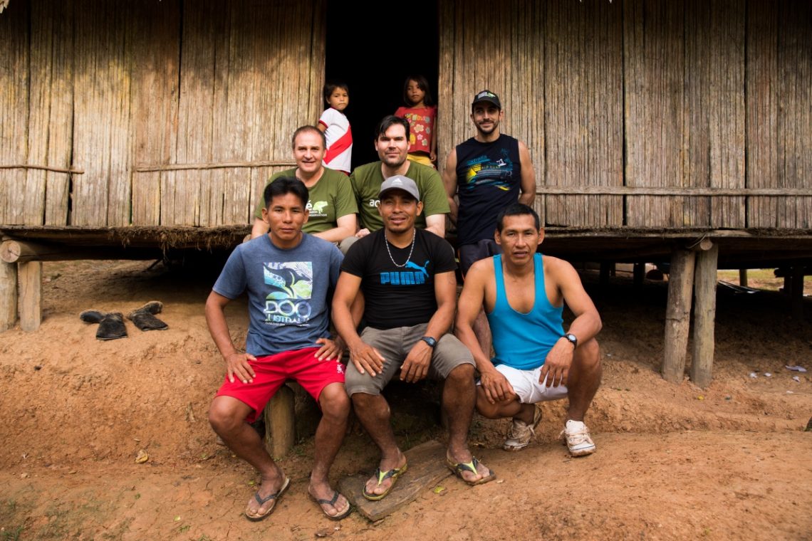
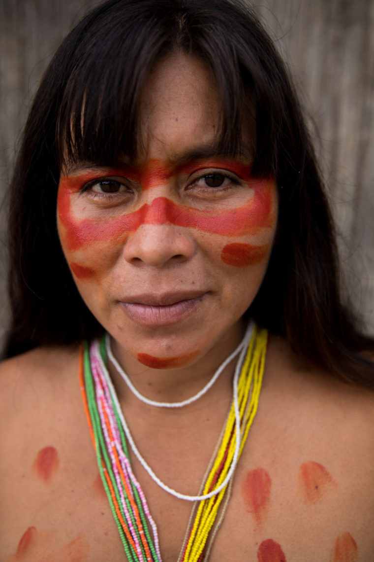
The meeting was led by Wilder Gonzalez Flores, High Chief of the Matsés People and the Matsés Council. The leaders from 13 of the Matsés communities attended along with mapping team members, and many other Acaté project participants. Acaté was represented by Felipe Bai, Mariano Lopez, Segundo Reyna, David Fleck, Christopher Herndon, and William Park.
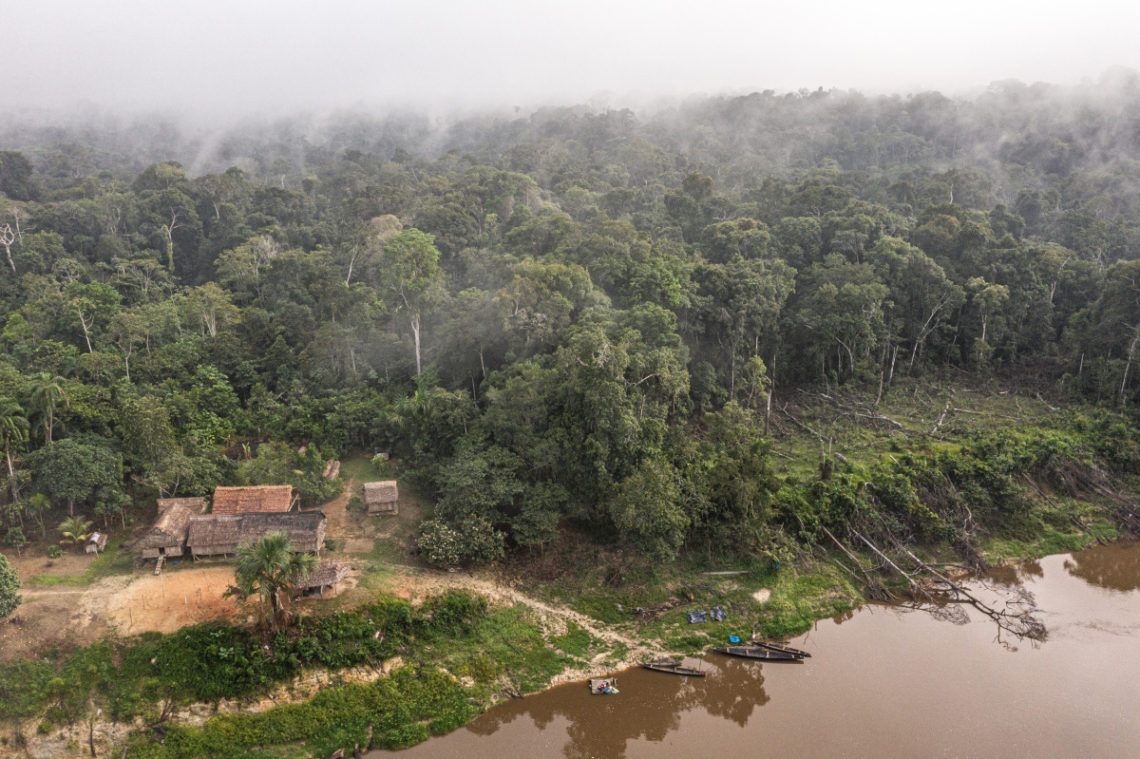
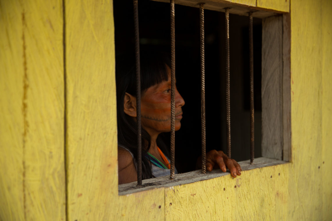
The ancestral lands of the Matsés comprise an area of 3.7 million acres in Peru and contain among the most intact, biodiverse and carbon-rich forests in the world. Their communities safeguard and shield some of the last remaining uncontacted tribes living in isolation from unwanted encroachment by the outside world. With the accelerated rates of deforestation and fires in the Amazon Basin, this vast area of intact primary forest that generations of Matsés have fought to protect is of vital importance for their future and is of global significance.
Before the Matsés Indigenous Mapping Initiative, the few maps of Matsés lands were those created by non-Matses that depict an empty landscape. A few scattered dots along the large rivers that represent their present-day settlements are the only evidence of Matses inhabitation. Only the largest rivers are named in Spanish. To the Matsés, the caretakers of these lands, the blank areas on these maps were not voids but the living heart of their territory.
At the initiation of this project the Matsés rich knowledge of their lands and ancestral history resided only in the memory of their living elders. The Matsés recognized the urgency to complete this initiative as the remaining elders were reaching an age where it is increasingly difficult to walk to remote cultural and historical sites. The loss of this knowledge would sever their timeless ancestral connection to their lands.
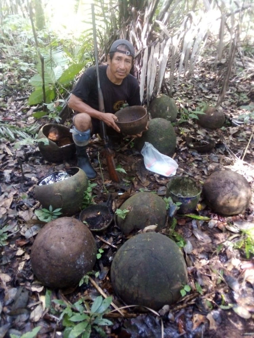
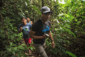
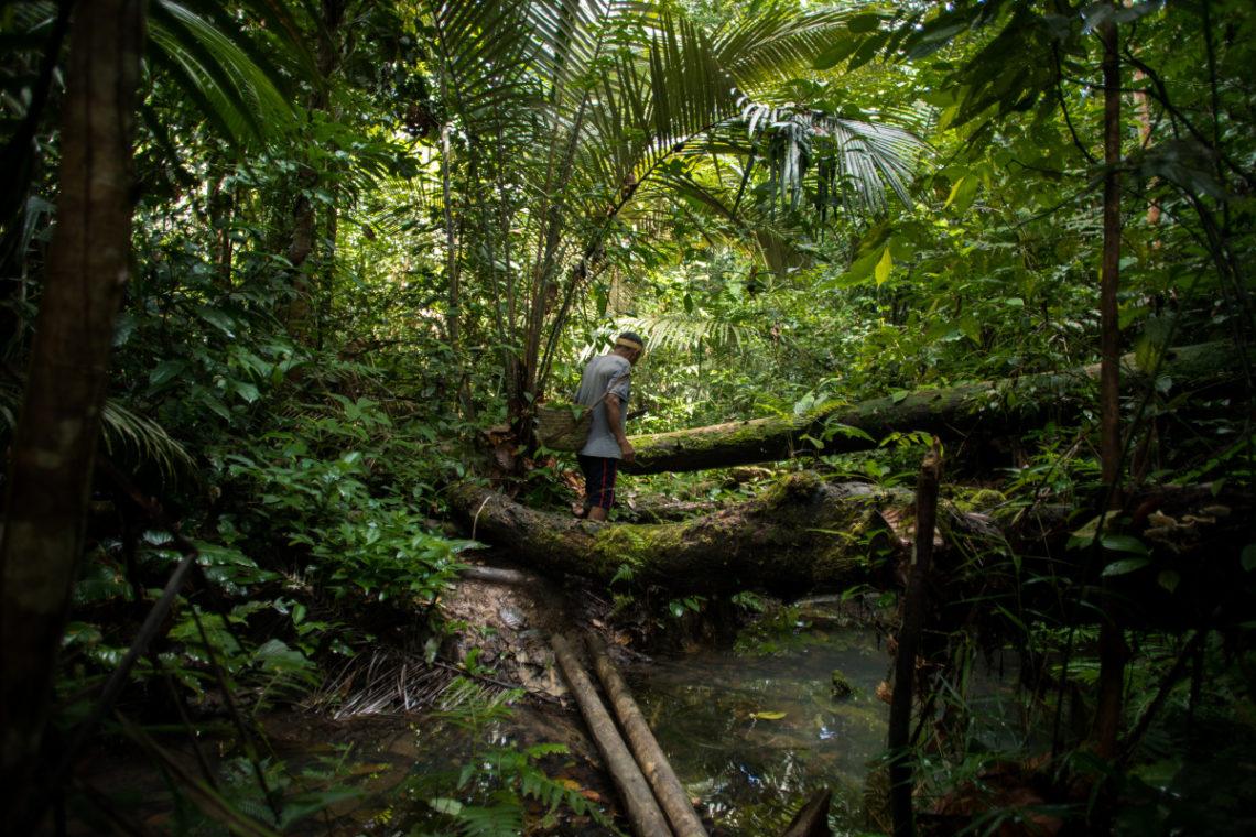
With support from Acaté Amazon Conservation, the Matsés received training in basic computing and in the use of GPS units. In an undertaking of immense scale over five years, teams of Matsés, led by elders, traveled throughout their land and deep into their headwaters to record thousands of culturally important mapping points including locations of ancestral longhouses, sites of frontier skirmishes with Peruvian soldiers and areas of ecological importance. All of the waterways in their territory were recorded for the first time with their original Matsés names.
Computer literacy among the Matsés, as with other remote Amazonian tribes, is extremely low. Most of the participants had never opened up a laptop before the start of the project. The project began with basic computer usage training, followed by word processing and spreadsheet lessons. This capacitation for the project imparted a highly valuable skill set to the Matsés who participated, and in-turn could train others. Over time, classes advanced to use of the GIS (Geographic Information Systems) mapping software.
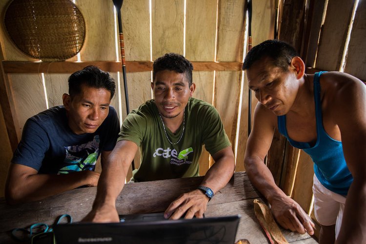
Through capacitating the Matsés with the ability to use the complex mapping software, the project took a major step forward from prior participatory mapping initiatives undertaken with other Amazonian indigenous groups. The ability to create and generate maps for themselves will give Matsés a powerful tool to use in governing their territory and protecting its resources. The intact rainforests that comprise the Matsés territory exist today because the Matsés have fought to protect them. For centuries, the Matsés have been locked in conflict with outsiders encroaching on their lands set on resource extraction, from the rubber barons of old to modern-day multinational petroleum corporations. The maps will be an instrumental tool for present and future generations of Matsés to protect their lands from extractive industry and future attempts to dispossess them.
Launching the Matsés Indigenous Leadership Initiative
At the meeting, the Matsés leadership and community representatives laid the foundation for our next major collaboration, the Matsés Indigenous Leadership Initiative. In this new initiative, the Matsés will build on the capacitation generated in the mapping initiative to obtain technical training in three core domains critical to their survival and success in their interactions with the outside world: 1. computer literacy training, 2. management skills training (accounting, legal, project management), 3. leadership training. The result will be a new and enhanced capacity to communicate and interact with the outside world.

Capacitation in these domains will strengthen the ability of the Matsés to represent themselves to the outside world, navigate the bureaucracies of government agencies, participate in the national economy, and enhance coordination of their communities to foster strength in unity. Through this initiative, the Matsés will be better able to resist the powerful external forces that threaten the environment they depend on for their survival and sustain their unique way of life. The initiative will engage younger generations by inspiring youth that their identity as Matsés can lie in both traditional and modern systems, and that to choose one is an artificial choice; one can thrive in the outside world, yet retain a proud identity as Matsés.
The Matsés Indigenous Mapping initiative was made possible through funding from the Irwin Andrew Porter Foundation, New England Biolabs Foundation, Onaway Foundation, Swift Foundation, Francis and Christine Martin Family Foundation and private donors. We are grateful for their support.
Acaté Amazon Conservation is a non-profit organization based in the United States and Perú that operates in a true and transparent partnership partnership with the Matsés people of the Peruvian Amazon to maintain their self-sufficiency and way of life. Operating at the leading edge of conservation, our initiatives have included the first indigenous medicine encyclopedia as well as projects with original methodology in sustainable economic development, traditional medicine, medicinal agroforestry, nutritional diversity, regenerative agriculture, biodiversity inventory, education, and native language literacy.
The Matsés safeguard one of the great areas of rainforest on the planet, protecting a region of over 3 million acres in Perú alone and shielding some of the last remaining uncontacted tribes in voluntary isolation from unwanted encroachment from the outside world. All of our initiatives are developed, led and implemented by the Matsés indigenous people. Donations are tax-deductible and go directly to fund these on-the-ground initiatives that operate at the leading edge of conservation with unparalleled transparency.
Stay tuned soon for more reporting on our work including a major update on our native language literacy and education programs! If you missed it, take a look at our July 2019 Field Report profiling our extraordinary partnership with Xapiri that is generating much need economic opportunities for the Matsés. The absorbing interview with Xapiri team members Jack Wheeler, Tui Anandi, and Mike van Krutchen is a must read!
All content and images copyright 2019 Acaté / Xapiri / Tui Anandi / Mike van Kruchten