Advancing the Matsés Indigenous Mapping Initiative
The Matsés map their headwaters in landmark quest to demarcate their ancestral lands
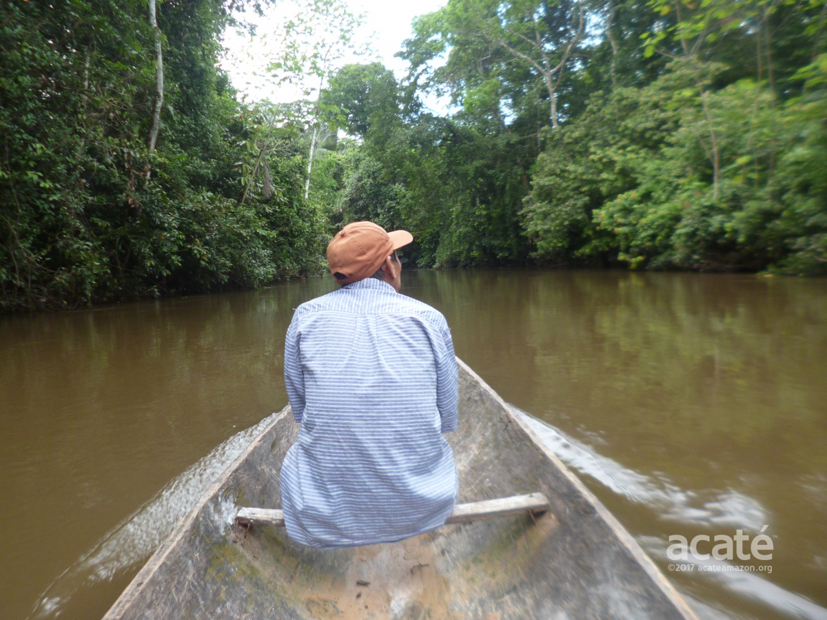
 Nothing could stop us from reaching our annual meeting with the Matsés. Planning for the meeting was in the works for months in advance to coordinate the participation of the delegations from each of the 14 remote Matsés communities along with the Acaté project participants and elders. Our flight from Iquitos to Colonia Angamos, the military outpost that is the frontier gateway to Matsés territory, was backlogged due to delays on account of weather and an Australian reality TV show that had fully ‘chartered’ two Air Force civic planes to bring their crew and equipment. Arriving in Angamos late, we had to set out at once on the two-day journey to Buenas Lomas Nueva, the site of our meeting, on the Chobayacu River.
Lower Javari river at Colonia Angamos©Acaté
It was with some trepidation that we decided to try the first leg of the eighteen-hour journey in a dugout canoe with a small motor during the night. The first few hours traveling up the Javari river went smoothly as we watched the sun set beneath the canopy. As darkness set in, we knew that the difficulties and challenges of navigating the river would amplify, particularly once we turned onto the much smaller Chobayacu River. Segundo Reyna, our Matsés field coordinator, masterly navigated us through the darkness and fog banks using a flashlight to spot the numerous submerged branches and tree trunks exposed by the unseasonably low water levels. It was already two in the morning when we arrived, exhausted, at the first village on the banks of the Chobayacu and dared not press further upriver until first light.
Waking up a few hours later, our spirits were buoyed by the prospect of reaching Buenas Lomas Nueva in time for our meeting. We set off after breakfast on what we hoped would be an eight hour journey. Our optimism were dashed about an hour upriver when our wooden canoe suddenly hit a submerged tree trunk, tipping the canoe and allowing the swift current to flood it. The canoe sunk to the bottom of the river in seconds. As we scrambled to cling to the muddy banks of the river with our valuables perched on our heads, Segundo started to grab some of our bags that were floating downriver. As we were raising the canoe from the riverbed and collecting almost all of our soaking wet equipment, a family of Matsés showed up and towed us to the nearest village. Through a stroke of good fortune we had loaded our most precious cargo in another canoe: the first printed maps of Matsés ancestral territories to present at the meeting.

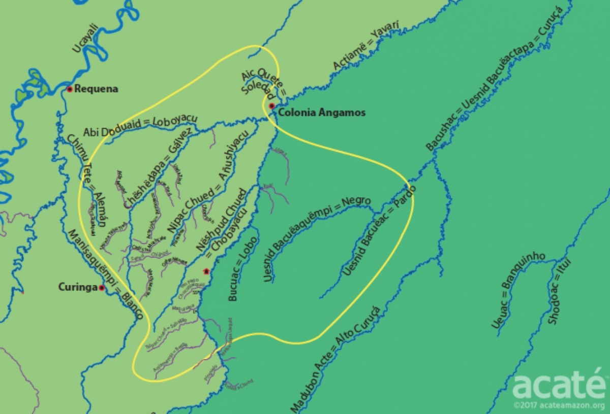
Before the Matsés Indigenous Mapping Initiative, the only maps of the Matsés territories like the one pictured above were created by and for the purposes of national governments or extractive industries. The seeming emptiness of the land is punctuated only by a few scattered dots along the rivers representing politically recognized present-day settlements established by missionaries. Only the largest rivers are named, in Spanish. This is not how the Matsés, the original inhabitants, and caretakers of these lands, view or understand their rich ancestral landscape. The blank areas on the map are not voids but are the living heart of the Matsés territory.©Acaté
The Matsés had never before mapped their lands or formally recorded the locations of important ancestral sites or even their names for their rivers. Two years ago, at our annual meeting in 2015, the Matsés leadership and representatives from all 14 communities launched, with the support of Acaté, a major new initiative to map their traditional territory according to their own history, culture, and language. The scale and importance of this initiative is staggering. The Matsés traditional homeland exceeds 3 million acres of primary rainforest in Peru alone! This region contains some of the most intact rainforests in the world as well as shielding some of the last remaining uncontacted tribes hiding in isolation. They seek refuge here, in this the most remote corner of the Amazon, to maintain their sovereignty and way of life but are deeply vulnerable to exposure to disease and the destructive influences of the outside world.
The Matsés communities on the Brazilian side of the Javari River frame the western borders of the Vale do Javari Indigenous Reserve, a region roughly the size of Austria that contains the largest number of ‘uncontacted’ tribes in voluntary isolation remaining in the world.©Acaté
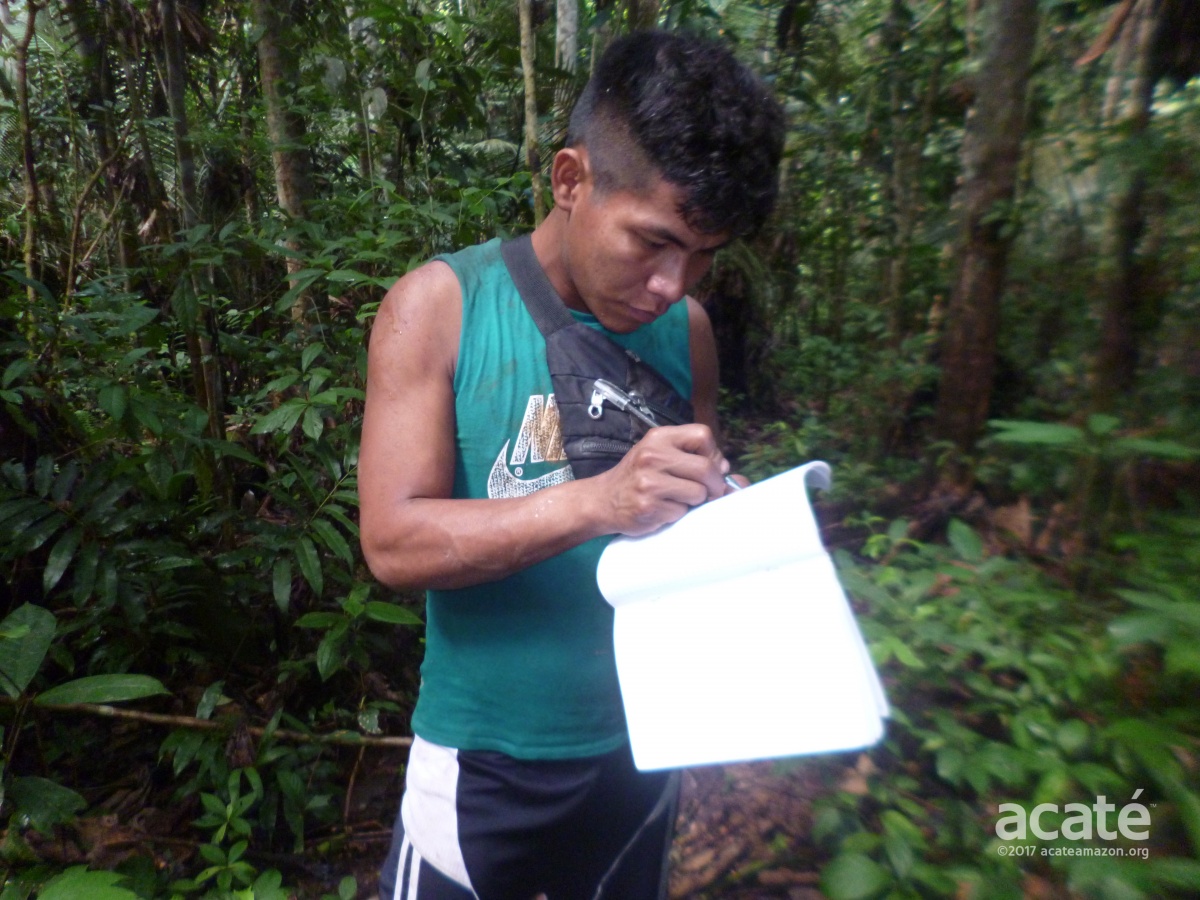
The Matsés created a plan of action in order to map their vast homeland and transmit their ancestral knowledge to future generations. From each region, they created teams of three comprising: one Matsés GPS expert, trained by Acaté; one elder or expert on the territory and one apprentice who would learn the traditional geography as well as the use of the GPS unit. The plan also included a list of 17 categories of sites to map. These categories included places of cultural significance, such as ancestral villages and burial sites along with the names of waterways. Additionally, important ecological areas including hunting, fishing, gathering and trapping sites were mapped. Each team was equipped with notebooks, a camera, along with the handheld GPS units. The younger Matsés job was to document as much information about the localities from the elders as possible.
Preliminary work done by Acaté Field Coordinator Dr. David Fleck. It is a sad reality today, that just a few short decades since the initiation of sustained contact with the outside world, most of the Matsés youth only know the recently given Spanish names of the rivers. Prior to the Matsés Indigenous Mapping Initiative, much of the Matsés ancestral knowledge of their lands was on certain trajectory to being irretrievably lost.©Acaté
The Pilot Mapping of the Javari Headwaters
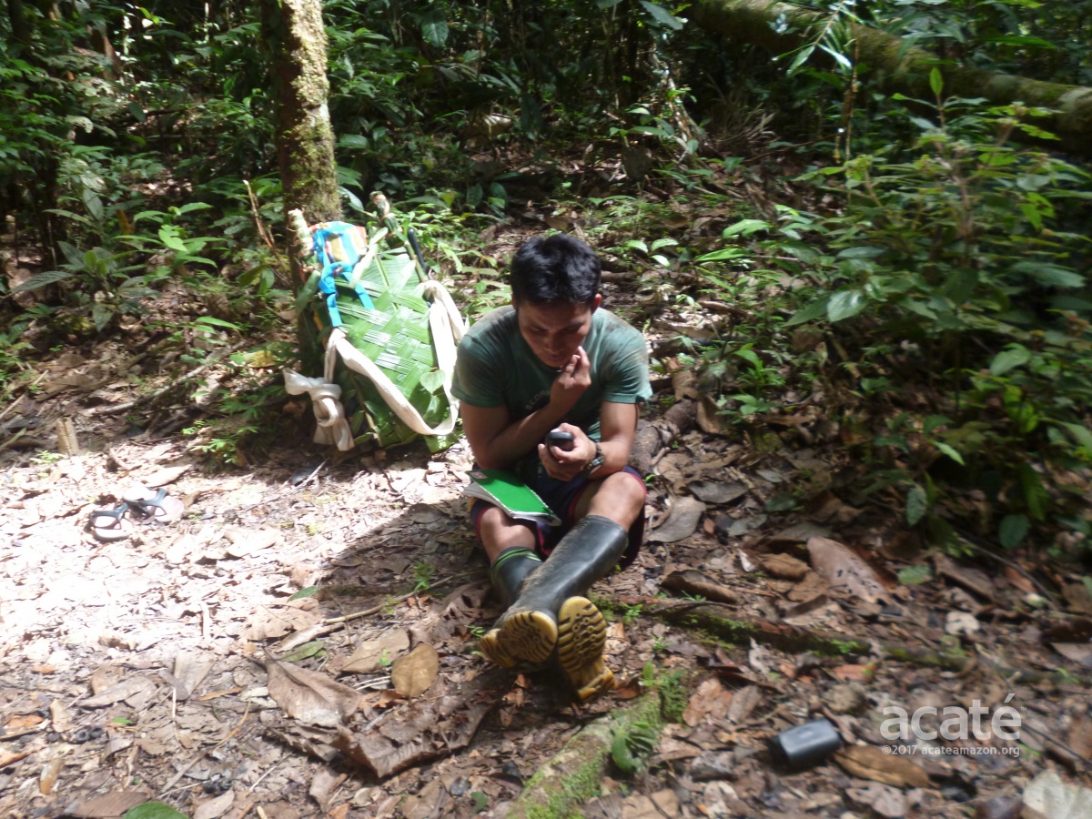
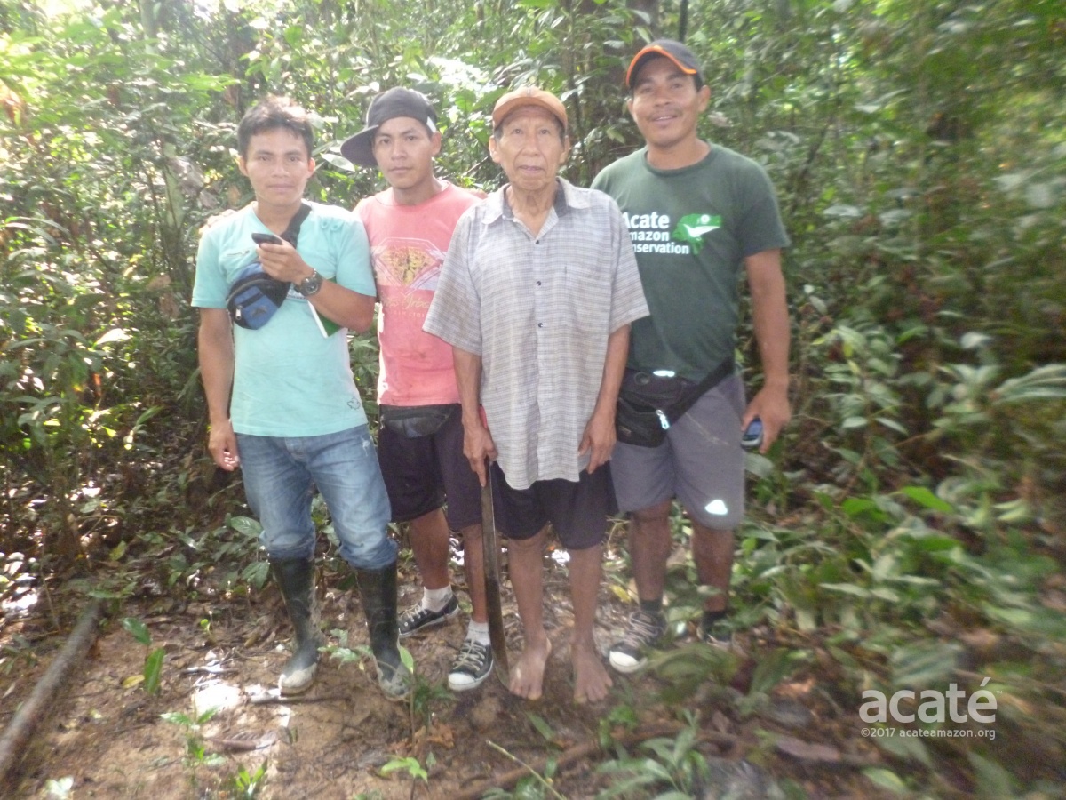
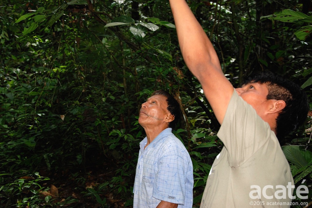
In December 2015, Matsés elder Rómulo Tëca Nacua Chapa, from the village of Puerto Allegre, spearheaded the pilot initiative to map the headwaters of the Javari River, at the southern boundary of their territory. He was accompanied by Aaron Nacua Tëca Bëso, a younger Matsés trained by Acaté to use a handheld GPS unit. This extremely remote area can only be accessed by canoe after the seasonal rains raise the water levels allowing for easier passage upriver.
In our meeting in May 2016, Matsés elder Rómulo stood and powerfully addressed the gathered assembly of the Matsés leaders in formal Matsés oratory. He spoke of his experiences traveling for three weeks with Aaron and camping together far into the upper reaches of Javari river. Ancestral knowledge, he said, was no longer being handed down to the younger generations and rests only in the memories of the remaining elders.©Acaté
At the last day of the same meeting where Romulo spoke, the importance of the mapping initiative became apparent in immediate and concrete terms. The Matsés leaders were forced to convene an emergency meeting to respond to an attempt by the Peruvian Government to create a ten kilometer buffer zone within Matsés territory on the Upper Javari encroaching beyond the previously agreed upon lines. Although this attempted land grab was decried and unanimously rejected by the Matsés it reinforced the pressing need to demarcate their own traditional territories and acquire the independent ability to create maps and refute future attempts to seize or redesignate their lands. The assembly stood strongly behind the critical importance of the mapping initiative for the future of their people.
An Indigenous Mapping Initiative
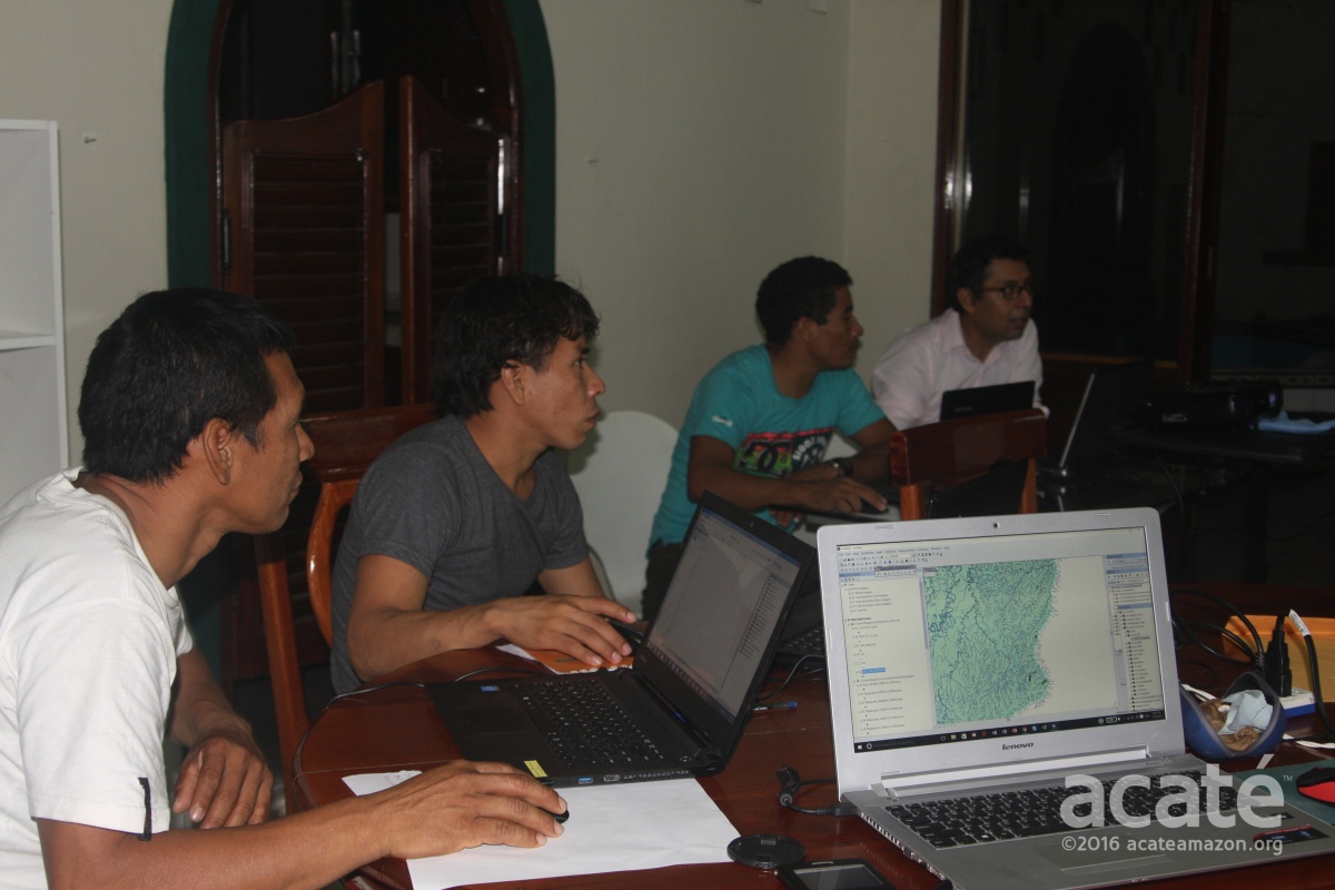
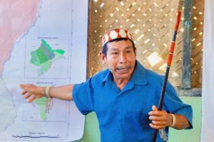
Our mapping initiative is anchored on the remarkable work and precedence set by prior participatory mapping initiatives over the past decades. In these projects, indigenous peoples were trained in the use of handheld GPS units to record culturally important mapping points. Particularly with projects involving recently contacted indigenous groups, the maps themselves are usually put together and created by partner organizations and NGOs with expertise in the highly complex mapping software. Media images associated with such projects, like a picture of an indigenous elder in a red loincloth in front of a laptop, belie the reality that computer literacy is low among recently contacted indigenous groups. Acaté’s mapping initiative has taken a major step forward by training the Matsés to use the GIS mapping software to produce the maps themselves, independently, thereby providing them the ability to revise current maps or create new maps in the future.
We knew we were entering into uncharted territory by attempting to teach this complex software to our indigenous partners, who are highly resourceful and motivated, but lacking in computer experience. Some of them had never even turned on a laptop before! Daunting as it might seem, this challenge brought with it a critically important opportunity to capacitate the Matsés in computer literacy. As with the historic Matsés Traditional Medicine Encyclopedia initiative before it, the Matsés Indigenous Map will be created entirely by the Matsés themselves, in their language and for their communities. Acaté will facilitate the project by supplying all the support and tools to bring it to reality.
Our agreement with the Matsés leadership was that we would train the trainers. In other words, the Matsés that received the training would then volunteer their skills to train other Matsés, and so forth. The first training class held in Iquitos in July 2016 consisted of Matsés, Acaté staff and Matsés leaders. The classes were broken up into long morning and afternoon sessions. The morning session was devoted to very basic computer use and word processing while the afternoon session involved a graduated introduction to the GIS software. The team members who had some skills or aptitude with computers helped those who started with none.
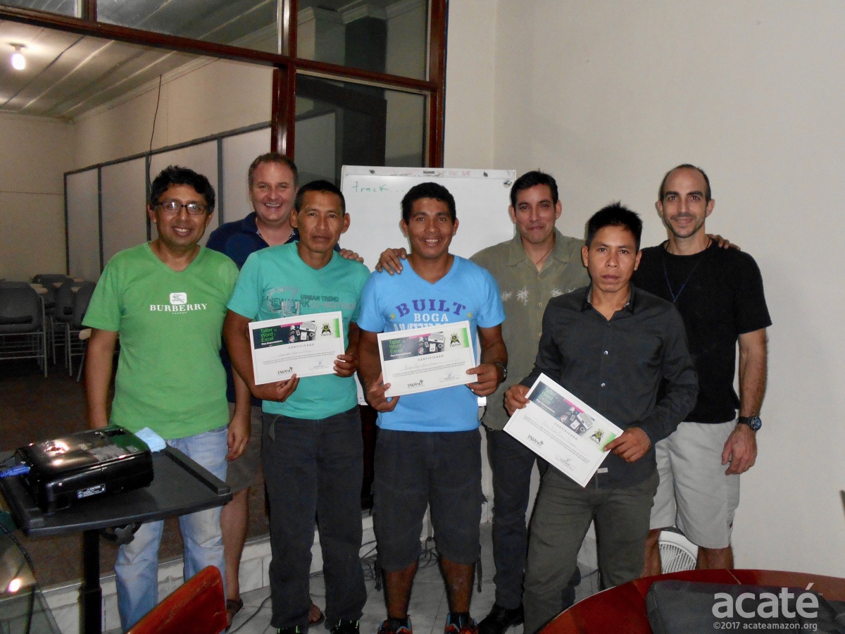
Computer literacy among remote tribes, such as the Matsés, is low. To learn how to use the complex mapping software, the first step were classes and certification in basic computing and word processing. This capacitation for the project imparted a valuable skill to the Matsés who participated, who in turn could train others in their language. Pictured here receiving their certificates are Matsés Segundo Reyna Perez, Felipe Bai, and Felix Mebu accompanied by Acaté Co-Founder Bill Park, Field Coordinator Dr. David Fleck, and computer instructors.©Acaté
You can imagine how daunting it might be to learn complicated software package starting from having no idea how to even turn on the computer or even knowing where the letters are on the keyboard. To make all this even more impressive the GIS software is only in English so the Matsés had to memorize the menus and commands.
Instructors started the Matsés with basic tasks such as plotting points and progressed to more advanced features.©Acaté
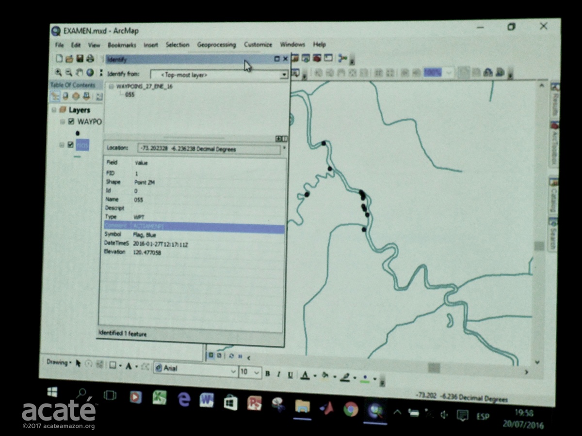
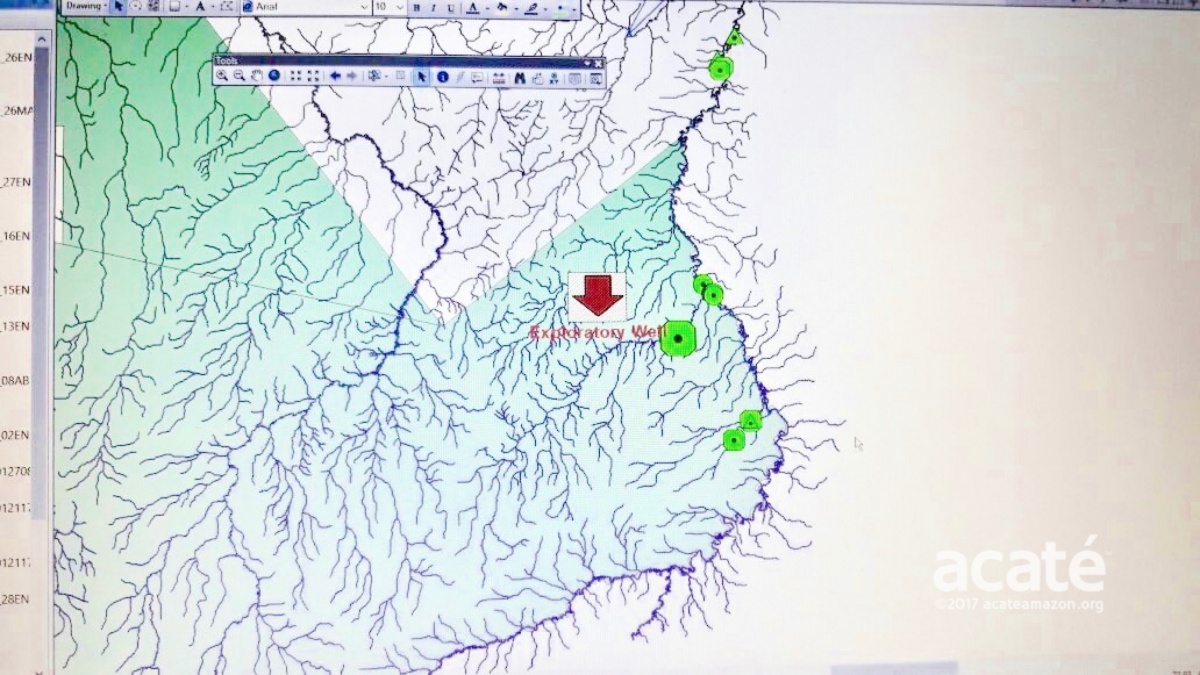
At first the task seemed impossible and the GIS software far too complex. But as the data from Romulo’s pilot voyage was transformed from the abstract pages of coordinates in a notebook to on-the- screen historical points and rivers, morale improved, re-energizing the initiative. They even overlaid the coordinates of an exploratory petroleum well by Pacific Rubiales and found that it overlapped the area Romulo demarcated in the Upper Javari as an important ancestral area!
Despite a recent claim heralding victory with Pacific Rubiales’ pullout from Lot 135, in reality the pullout was already in process and driven by economics. Pacific is restructuring due to fiscal troubles and the current low price of crude renders extraction in the most remote areas of the Amazon less profitable. This can change. At present, the lot remains open and could be purchased by another petroleum company, such as from China who are actively drilling in Yasuni National Park in Ecuador. The only metric of victory can be the annulment of the concession and the land rights being permanently handed over to the Matsés indigenous people.©Acaté
Mapping of the Galvez / Loboyacu Headwaters
After a week of intense mapping software and computer use workshops, the Matsés were ready to get back out and map more territory. Now confident that with more practice and capacitation the project would indeed be feasible. Under the guidance of elder Matsés and shaman Roberto Tumi Nëcca Unan, the team began to map the headwaters of Galvez and Loboyacu rivers at the north and northwest margins of the territories. These areas contain some of their most important historical sites including the battle site of a skirmish with the Peruvian Army.
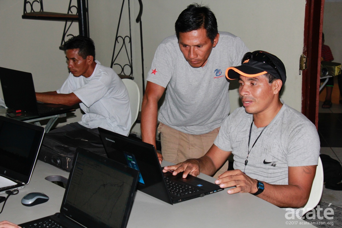
On their return, after two months in the field with all the new data in hand, we were ready to start our next in-depth workshop on the GIS software. We started this two-week all day marathon of training classes in February 2017. Here, Matsés High Chief and President of the Junta Directiva Wilder Flores works with Felipe Bai on the mapping software.©Acaté
The mapping team was joined this time by Mariano Lopez Rengifo. Mariano had distinguished himself previously as a medicinal-plant intern and remarkably during the mapping project as an apprentice GPS user. He happened to be in Iquitos and we had an extra spot in the class so we decided to invite him even though he had literally never used a computer before. Like Segundo and Felipe before him, he was able to pick up computer skills and applications at an astounding rate! ©Acaté
Mapping of the Chobayacu Headwaters
In the two months leading up to the 2017 annual meeting, a team led by Matsés elder Marcos Bina mapped the headwaters of the Chobayacu River. The Matsés traditionally lived in this area because it was very remote and far from any major rivers that enemies could use to find and attack them. Their treks to reach ancestral sites and old trails were long journeys through both swamps and hilly areas and were extremely arduous, even for the Matsés! We have rarely heard Matsés comment on the difficulty of treks, and this is all the more remarkable considering most outsiders would find their daily paths to their jungle farms to be a trek.
Matsés elder Marcos Bina led the mapping team deep into the ancestral headwaters of the Chobayacu.©Acaté
Chronicling the mapping of the headwaters, all the photographs seen here were taken by the Matsés themselves!©Acaté
The mapping team went deep into the most remote reaches of the headwaters recording GPS coordinates of ancestral sites.©Acaté
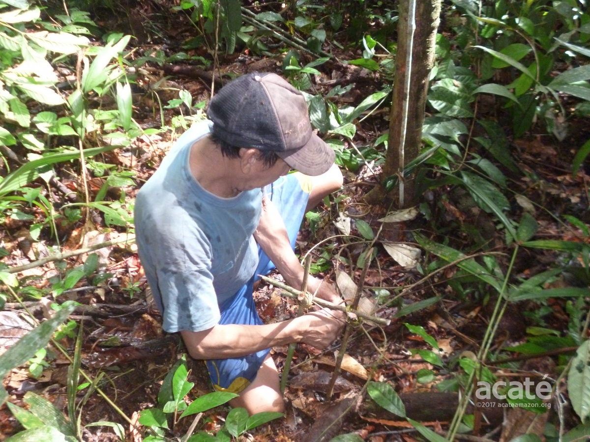
The long treks in the mapping work were an opportunity for the younger Matsés to learn from the elder masters. Here Marcos Bina is demonstrating traditional ways of making a hunting trap.©Acaté
Preparation of the First Maps of the Ancestral Headwaters
Felipe brought the Choboyacu data back to Iquitos a week before we were scheduled to depart for the annual meeting. This left us with little time to enter the most recent data and prepare all the printed maps. In Acaté’s small office in Iquitos, accompanied by Felipe, Matsés High Chief Wilder Flores and mapping instructor Marcial, we worked late into the evening.
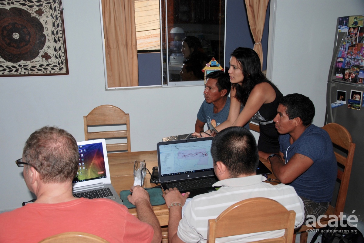
Acaté Director Bill Park, Carla Noain, Matsés High Chief Wilder Flores, Felipe Bai, and mapping instructor Marcial work late into the night to put together the first ancestral maps in time for the upcoming meeting.©Acaté
Being able to visualize the data graphically as a map fundamentally changed how we thought about the Matsés landscape. Firstly, we had perceived the headwaters of the Galvez and Chobayacu Rivers to be distinct areas as represented in geopolitical maps of the area. On the new map, the large green void of seeming emptiness between the two rivers disappeared. The two seemingly disparate headwater systems clearly converged to create one continuous arc of indigenous habitation. The Matsés had traditionally avoided the rivers and traveled by foot to avoid detection by enemies such as rubber tappers or later Peruvian soldiers.
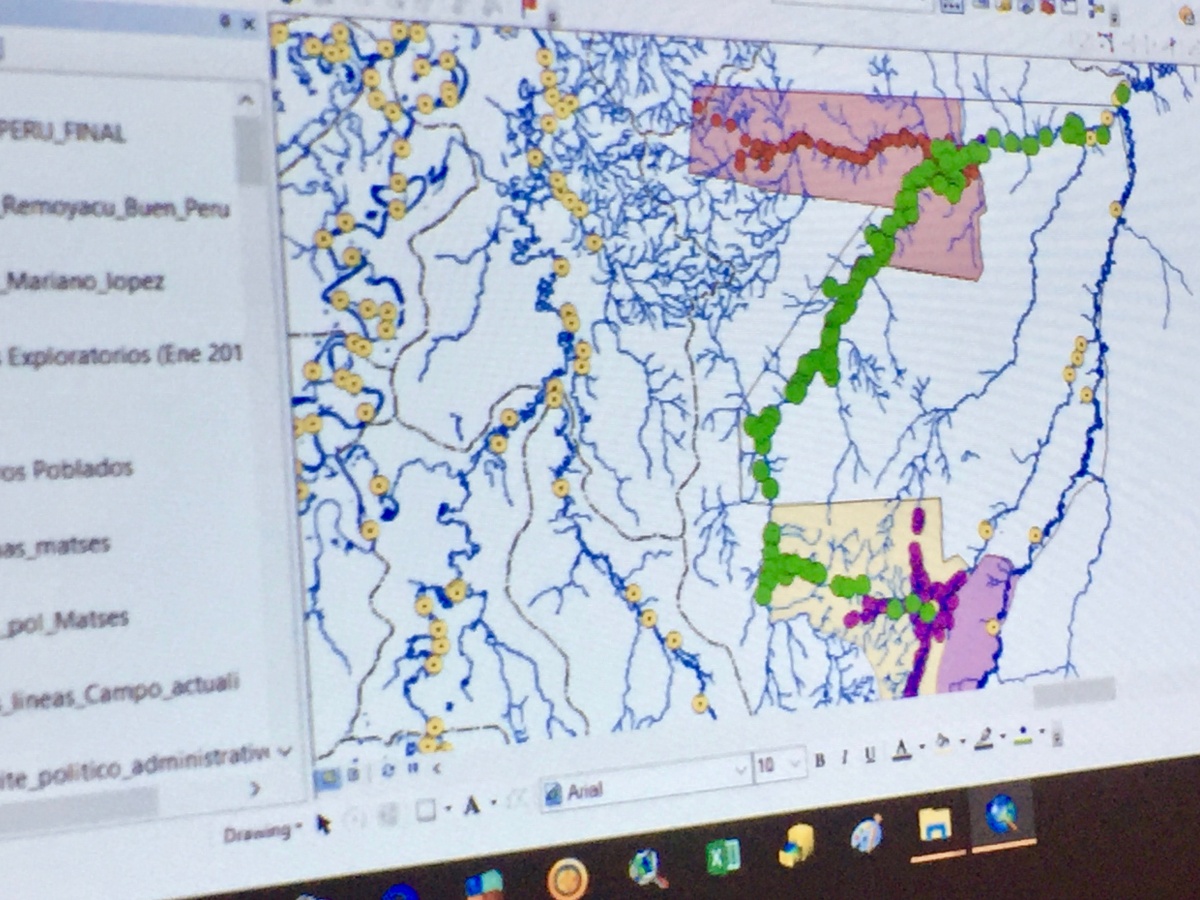
An unbroken arc of indigenous habitation©Acaté
The greatest shock came when the demarcation of government-titled lands – the so-called Matsés National Reserve and recently created Sierra del Divisor National Park – were added in and overlaid onto the display. The resulting map left us all in silence, contemplating the reality that Matsés ancestral land use extended deeply into lands that have been ceded to the government and are no longer under Matsés control or ownership.
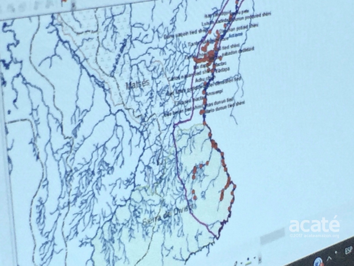
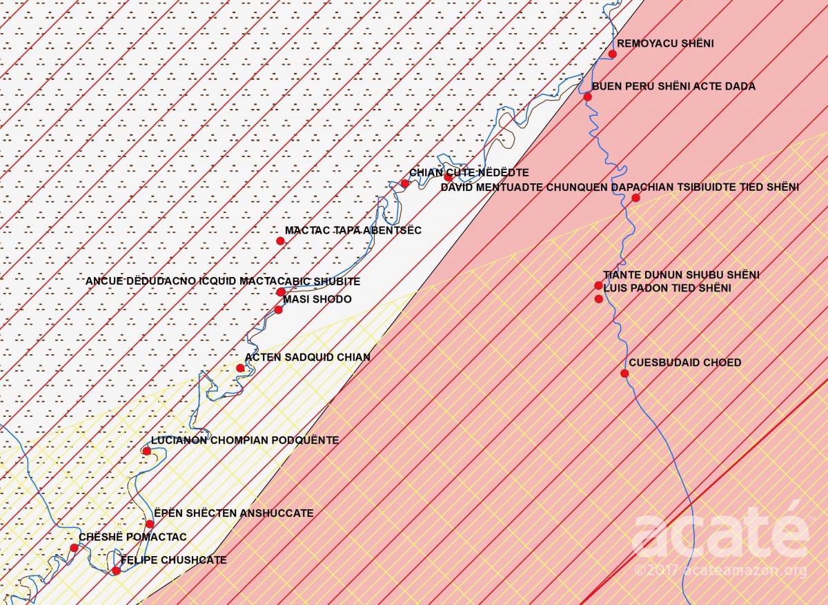
GPS points (in red) of Matsés ancestral sites and land use extending into Sierra del Divisor National Park.©Acaté
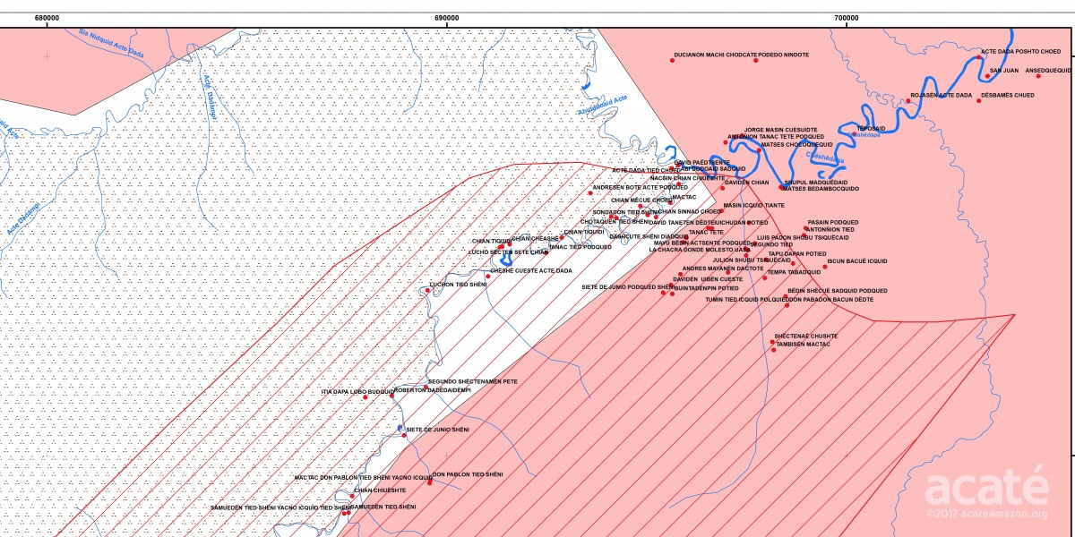
Maps of the Javari, Galvez, Loboyacu, and Chobayacu headwaters were prepared for presentation and review at the upcoming meeting. We debated whether to include the political overlays in the maps we printed to present to the communities. On one level, the layering made the maps difficult to interpret. The output of most indigenous mapping projects is typically an elegant and simple wall map that aesthetically portrays historical and current indigenous land use with traditional names of rivers and other landscape features. Current geopolitical boundaries tend to be minimized in the representations, so the maps look almost as if they were produced before sustained contact with the outside world. The maps in front of us, with complex patterning from multiple overlays of government boundaries, titled lands, and petroleum lots were certainly less aesthetically appealing and more complex but at the heart of the struggle of the Matsés people for sovereignty and self-determination.
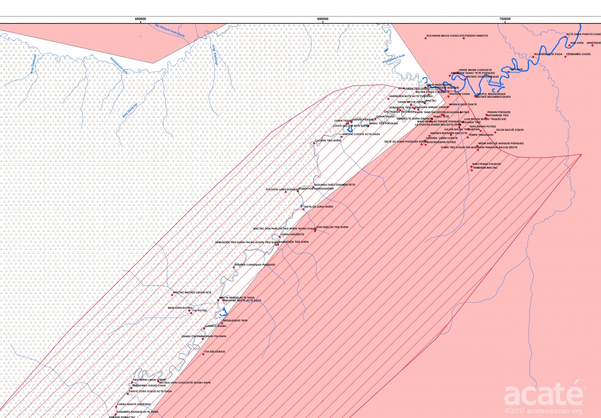
The scope of the Matsés Indigenous Mapping Initiative is truly staggering: the Matsés traditional territories in Peru comprise 3 million acres of rainforest. Represented here is one section of the large Galvez headwaters map.©Acaté
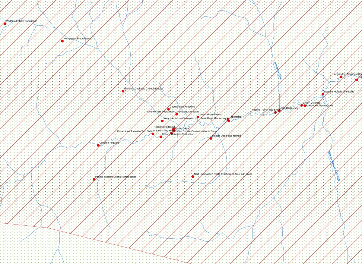
No longer blanks on the map: each high resolution and scalable map of the four headwaters contains hundreds of culturally important sites and names of small creeks in addition to the large rivers. Pictured here is a zoomed in close-up of a small area from the Loboyacu headwaters map.©Acaté
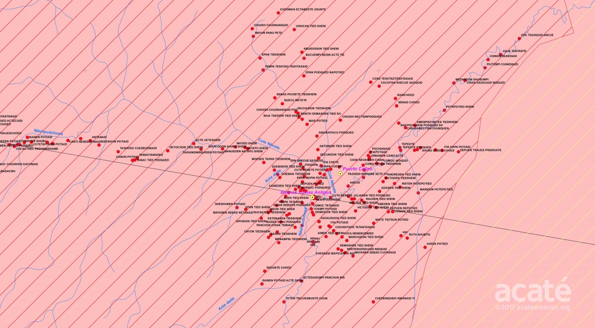
Mapping circumferential to the village of Buenas Lomas Antigua, the uppermost present day settlement on the Chobayacu river©Acaté
The complex patterning from multiple overlays of government boundaries, land titles, and petroleum lots make the maps not only a rich repository of ancestral knowledge but powerful and relevant tools to bring to the table in current day discussions of land rights.©Acaté
Since time immemorial, the Matsés history has been defined by interactions and conflicts with outsiders seeking to take their lands, women, children and resources. From the cruel tyranny of the rubber barons in the early 20th century to the 1940s when the Peruvian government sent soldiers on a mission of ethnocide to rid the upper Galvez of Matsés communities to contemporary petroleum exploration by multinational companies.
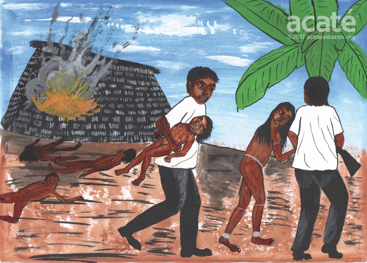
The past is not forgotten: rendering by Matsés indigenous artist Guillermo Nëcca Pëmen Mënquë©Acaté
We were hesitant as we knew the strong feelings and resentments it would generate among the Matsés, as the maps so clearly and unequivocally demonstrate that ancestral lands are no longer under their control. Matsés High Chief Wilder Flores affirmed his decision to present the maps with the overlaid government areas along with the ancestral Matsés land use. The next morning we had the approved maps printed and made our final arrangements before setting out to present the maps to the Matsés delegations that were beginning to assemble in Buenas Lomas Nueva.
The Meeting of the 14 Matsés Communities
Opening of the Acaté annual meeting in May 2017 ©Acaté
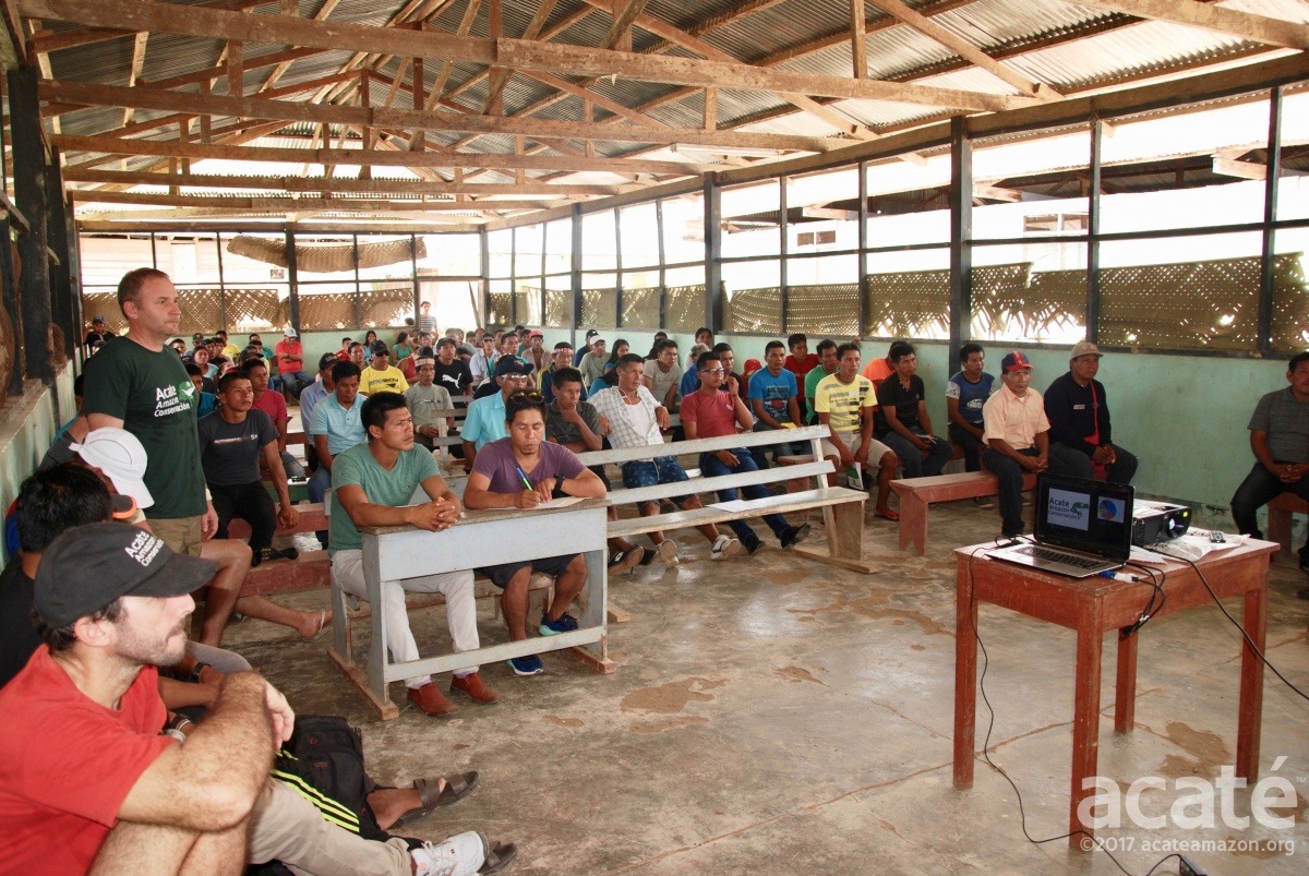
Despite the delays from the canoe sinking, we arrived at Buenas Lomas Nueva shortly before noon on the day that the meeting had been scheduled to start. Fortunately, the Matsés chief had been on the radio alerting all the delegations of the delay. Approximately 90 participants, including delegations from all 14 villages in Peru, Acaté project participants, Matsés shamans, elders as well as the Chief of the Brazilian Matsés were present.
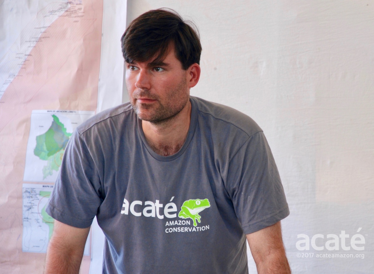
Acaté President and Co-Founder Christopher Herndon©Acaté
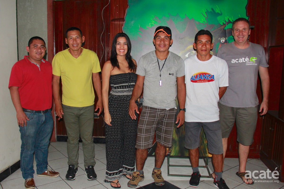
Acaté was represented at the meeting by Felipe Bae, Segundo Reyna Perez, David Fleck, William Park and Christopher Herndon.
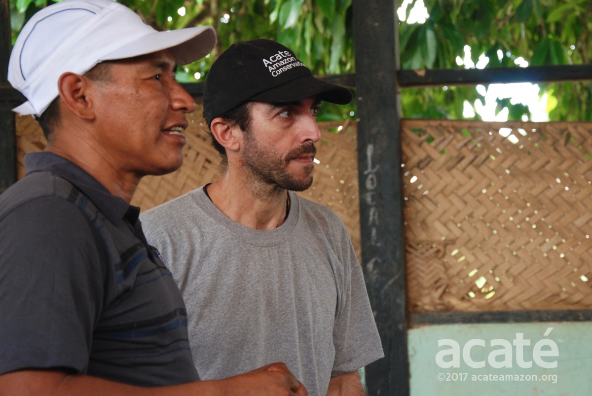
Acaté’s Segundo Reyna and Dr. David Fleck©Acaté
After opening remarks by Matsés High Chief Wilder Flores, we decided to begin with an open forum of questions and answers before launching into the meeting agenda. Not surprisingly, many of their questions were concerning financials and fundraising. Organizations working with Matsés and raising funds in their name rarely present their financials. We presented our annual financial report to ensure complete transparency and answered their questions. The discussion of finances was complex across cultural divides but it seemed clear to all that while Acaté operates on a shoestring budget, it does so with transparency and all of our funds are utilized to directly benefit the Matsés communities.
The first major agenda item for the meeting was the Matsés Indigenous Mapping Initiative. The printed maps we brought of their ancestral headwaters were fixed on the wall. Matsés Field Coordinator Felipe Bai took the floor and shared with the assembly his experiences working on the mapping initiatives using images projected onto a sheet. He detailed how he learned to use the GPS units, the mapping software and his most recent work deep the ancestral lands of the Chobayacu with Matsés elder Manuel Bai.
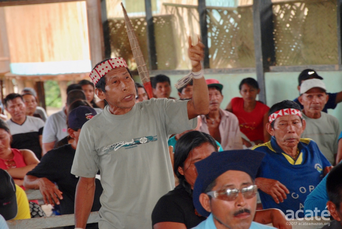
From the projected maps, Felipe pointed out their ancestral lands and the overlaps with areas now under government control. The assembly stared transfixed at the maps projected before them. The Matsés were seeing the overlap of ancestral and government titled lands for the first time. This information shifted the dynamic of the entire meeting. Matsés after Matsés stood up and angrily voiced their outrage that their lands were taken away from them and ceded to governmental control.
Matsés elder shaman and famed warrior Arturo contesting that the Matsés do not have titles to all of their ancestral lands.©Acaté
This continued throughout the day and even into the following day. One aspect we came to appreciate in the process of the mapping initiative was the sheer complexity of the land demarcation process and laws. What are the distinctions in Peruvian law between a communal reserve and a national reserve? How can a petroleum concession occupy the same area as the communal reserve and a national reserve? Can the Matsés farm or hunt in government lands when it is their ancestral lands? How were these negotiations conducted? Most importantly, were the Matsés properly informed and consented? It became apparent that the Matsés themselves were not clear on these issues. Given that most older Matsés do not speak Spanish or have literacy skills, much less understand bureaucratic jargon and legal procedures, this is not surprising.
It was a last minute change, after years of deliberations, where the large expansion of the Matsés Communal Reserve became instead a National Reserve under government control. There is deep resentment in the Matsés communities regarding the establishment of reserves that are not under their control or title. It is important to remember that these lands belonged to the Matsés not in some distant and abstract past, but in the living memories of the elders. Many elders reminded the assembly of their past lives in these areas and expressed dismay in what had been lost. The Matsés have a deep pride and consider themselves, whether they live on the Peruvian or Brazilian side, to be first and foremost part of the Matsés nation.
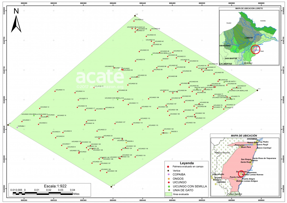
One of the immediate spin-offs of capacitation with the mapping project is the ability for the Matsés to create management plans necessary for the legal export and sale of renewable non-timber forest products that will bring badly needed economic opportunities to their remote communities. The management plans are complex, requiring GIS mapping of each individual tree that will be used for collection! Here Felipe demarcated in a plot the number of huicungo trees (Astrocaryum murumuru), the seeds of which can be made into rich butter used in high-quality cosmetics.©Acaté
In the minds of many, the creation of a national park or nature reserve automatically confers some type of forever protection, inviolate and sacrosanct. Oversimplified conservation messaging – such as save the rainforest for $3 an acre – taps into this presumption. The uncomfortable reality on the ground in the Amazon is that there often exists a disconnect between protected status in law and actual conferred protection. When land is appropriated from the traditional homelands of indigenous peoples to create parks under national control, paradoxically, it can often make the land more vulnerable to resource extraction. The laws of government may not be enforced or can be annulled or rewritten with a new administration in response to powerful industry lobbying.
As the maps objectively demonstrate, these rainforests have been the Matsés homelands for generations, their headwaters, hunting grounds, and sites of ancestral significance. No one is more invested in the survival and protection of these rainforests.©Acaté
The creation of the Matsés National Reserve, though heralded as “protecting” these lands, misses a fundamentally important point: These lands were already being protected. In fact, the rainforests that comprise the Matsés territory only exist intact today because the Matsés have fought, literally, shedding blood and tears, to protect them. The Matsés have fiercely defended and protected their lands from the rubber barons of old to modern day petroleum corporations. The Matsés villages are strategically located on the rivers and the trails that control access to this vast territory. The Matsés know that the law of the jungle is that you can only keep what you can physically protect.
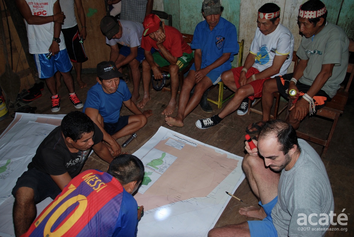
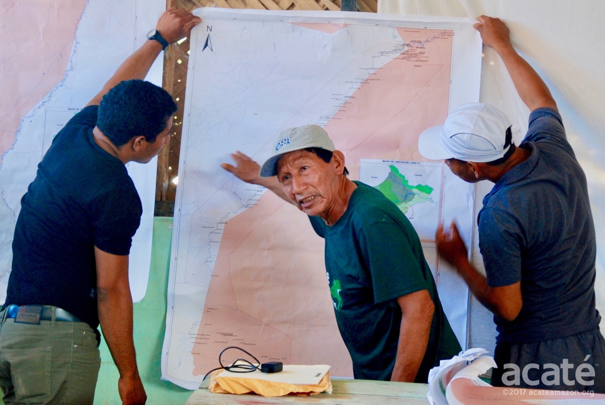
Review sessions for the map drafts with the Matsés elders gathered at the meeting went late into the night.©Acaté
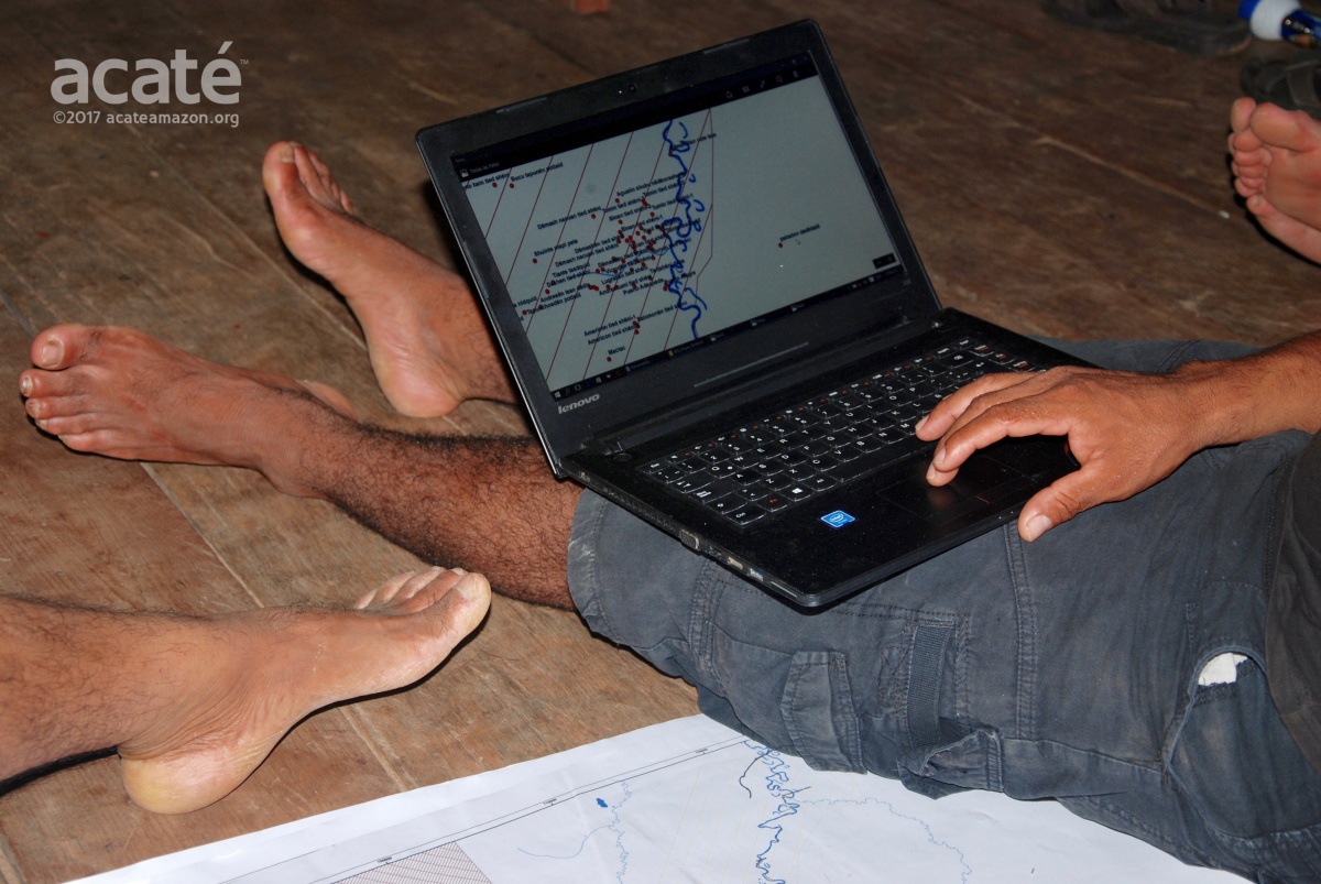
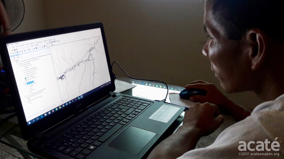
Felipe Bai, now proficient in computer and mapping software due to his advancement in the courses and diligent practice afterwards, making the revisions real time into the mapping software as the elders confer.©Acaté
One remarkable and positive development that emerged immediately from the meeting is that the Matsés can now use the maps to help negotiate the upcoming re-zonification plan with the Peruvian Government! Remarkably timely to our mapping initiative, the government is now conducting the five year review of their national reserve management plan and actively soliciting input from the Matsés! At our meeting, officials invited the Matsés to use their maps in this review process. Acaté representatives participated in a conference in Angamos held one week later related to the review and re-zonification. We look forward to working with government officials to assist the Matsés leadership to restore full access of the Matsés to their ancestral lands.
Completion of the first maps of their ancestral headwaters in Peru is an astounding accomplishment by the Matsés indigenous people. The next stage of the mapping initiative over the coming year will focus on areas of use in proximity to the 14 communities. These areas are even more rich with ecological and land use information and, fortunately, are easier to access than the most remote stretches of headwaters that defined their territorial borders. Stay tuned to new updates on this landmark initiative as the Matsés endeavor to complete the first comprehensive base maps of the entire Matsés territories in Peru as well as upcoming major update on our medicinal agroforestry project!
Your Donations Make All This Happen!
If you feel strongly about the Amazon, its life and its indigenous peoples, please consider making a contribution today to our on-the-ground initiatives! It is our pledge that your donations will be applied to our initiatives with the highest standards of efficacy, transparency, and accountability. Our on-the-ground initiatives operate at the leading edge of conservation and include the historic first indigenous medicine encyclopedia as well as several other innovative initiatives with original methodology in sustainable economic development, traditional medicine, medicinal agroforestry, nutritional diversity, regenerative agriculture, biodiversity inventory, and native language literacy among others.
Best,
The Acaté Team
Acaté is an on-the-ground conservation organization that works directly in a true and transparent partnership with the Matsés indigenous people to maintain their self-sufficiency and way of life. The Matsés safeguard one of the great areas of rainforest on the planet, protecting an area of over 3 million acres in Perú alone and shielding some of the last remaining uncontacted tribes in voluntary isolation from unwanted encroachment from the outside world.
Consider supporting our vital projects that maintain indigenous self-sufficiency and retains their ancestral healing knowledge at a critical time! Our projects rely on your support and your donations go directly to fund these on-the-ground initiatives that are redefining a new level of transparency and indigenous partnership in conservation.
Content, text and images ©2017 Acaté Amazon Conservation